Spatial data comes to us from a wide variety of sources including:
The accuracy and precision of the data will vary based on how it was collected. This will determine what the data can be used for an how good your analysis results are.
Geodesy is the science of measuring the shape of the Earth, map projections, and the transformation of coordinate locations from the Earth's curved surface onto flat maps. This includes field surveying.
Surveyors mapped every square mile of the continental United States by the middle of the 20th century. This was a huge undertaking and to this day you can be walking out in the wilderness and find small yellow signs nailed to trees that indicate the location of a "corner" that was surveyed years ago. These surveys were done without electronic equipment.
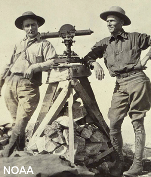
Early surveyors mapped the US without electronics
Today, satellites capture more data in a single day than surveyors could in an entire year. You've probably heard of "LandSat" and other "Earth-Observing Satellites". These satellites orbit the earth taking in huge amounts of data and beaming it down to facilities that make it available to us. Some of this data is available within minutes of it being sensed.
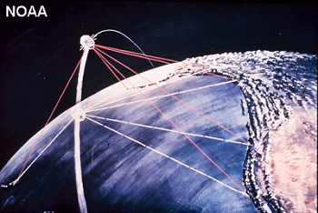
The LandSat satellite series has been capturing images of the entire earth at 30 meters per pixel for almost 30 years. This makes it the longest continuous satellite data set. LandSat covers the entire earth twice a month.
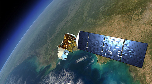
LandSat 8 satellite
A great deal of our data, including the NAIP images that we'll use in this class, come from airplanes that fly over head and effectively have cameras that point down toward the earth. These photos can be very high resolution and you can "task" a plane to fly when you want. However, you need to pay the pilots to do the flying and process the data and it costs about $30,000 per day.
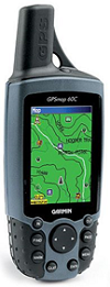
Modern Global Positioning System (GPS) handhelds can capture data at about 20 meters accuracy to less than 1 meter accuracy. The handhelds range in price from $100 to $5000. You can purchase a GPS and collect your own data quickly and easily but remember, all data has uncertainty and these handhelds can be off by 10s of meters.
The greatest benefit to GIS in the last 10 years has definitely been the Internet. We can now access and download data from just about anywhere in the world and the variety of data is constantly increasing. The problem is that this data is not only often of poor quality but it is rare that the quality is even documented. It will take some time to learn to do "Quality Assurance" checking on data from the Internet but over time, this will become your greatest source of spatial data.
© Copyright 2018 HSU - All rights reserved.